Enville is a small village in rural Staffordshire, England, on the A458 road between Stourbridge and Bridgnorth. Enville is also the name of the parish in which it lies.
The ancient parish of Enville extending to 4,986 acres lies in South Staffordshire adjacent to the county boundary with Shropshire. Today's parish is composed of the three medieval manors of Enville, Lutley and Morfe.
Until the late 18th century the name was spelt in a number of different ways, for instance Evenfield, Enfeld, Envil, Enfeild.
It is said that the name Enville means "smooth field" and is an apt description where most of the post medieval village is situated.
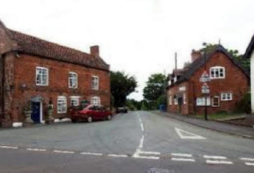
The tiny village consists of the Cat public house, a post office, a general store, an antique shop and around 100 houses.
Enville Golf Course is just outside the village and the nearest large village is Kinver, with the smaller villages of Bobbington and Six Ashes and "The Sheepwalks", a popular walking area, nearby, as is Kinver Edge. Enville is also the nearest village to Highgate Common.
The nearby small hamlet of Six Ashes marks the old border of two counties: Staffordshire and Shropshire and was the centre of the division of land as drawn up by the 1405 Tripartite Indenture between Owain Glyndwr, Edmund Mortimer, and Henry Percy, 1st Earl of Northumberland.
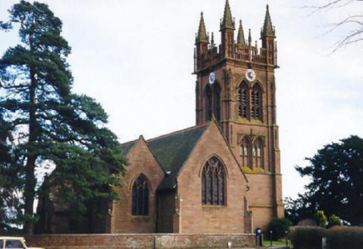
St Mary's Church
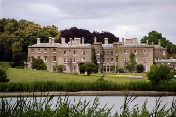
Enville village is dominated by the large Enville Hall estate.
Since the late 15th century the The Earls of Stamford have been Lords of the Manor of Enville, living at Enville Hall, to the south of the church which is still owned and lived in by the Grey family though the title is extinct.
The hall, which once boasted its own private racecourse (now a mere forestry track), remains a private house, but it hosts occasional events each year and the grounds are home to a recreational field, where Enville Cricket Club and Enville Athletic F.C. play.
The village is mentioned the Domesday Book, compiled in 1086 for William the Conqueror. It says that the manor of Enville contained 360 acres of arable land and 720 acres of woodland, the latter being held by the king as part of the forest of Kinver.
The earliest recorded name of the village was Efnefeld, and under that name it is entered in Domesday Book, the first part comes from the Welsh "cefn" a Welsh word meaning "ridge" or "hillside". The nearby village of Kinver derives from the same word.
The parish of Enville became part of Seisdon Union following the Poor Law Amendment Act of 1834.
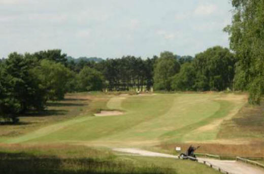
Enville Golf Course
St Mary's Church stands to the west of the village.
The present ornate tower was built in 1871, when the original tower was taken down. Evidence of an earlier church on the site is to be found in a small stone figure of Saxon origin built into the arcading above the south aisle.
The church has a Norman nave (about AD 1100) and a transitional chancel (built by Roger de Birmingham, AD 1272-1307) and despite extensive restorations in 1749 and 1871 the distinguishing features remain.
The church also contains four, 15th century misericords, which are placed on either side of the choir stalls.